AI-Verified Maritime Baseline Registry

Helping Pacific islands keep proof of where their coast used to be

As seas rise, the coastlines that Pacific nations' ocean borders are measured from are quietly changing. Hold the Line uses satellites to build an ongoing, trustworthy record of that coastline — before anyone needs to prove it in a dispute.

18 24 12 9 16
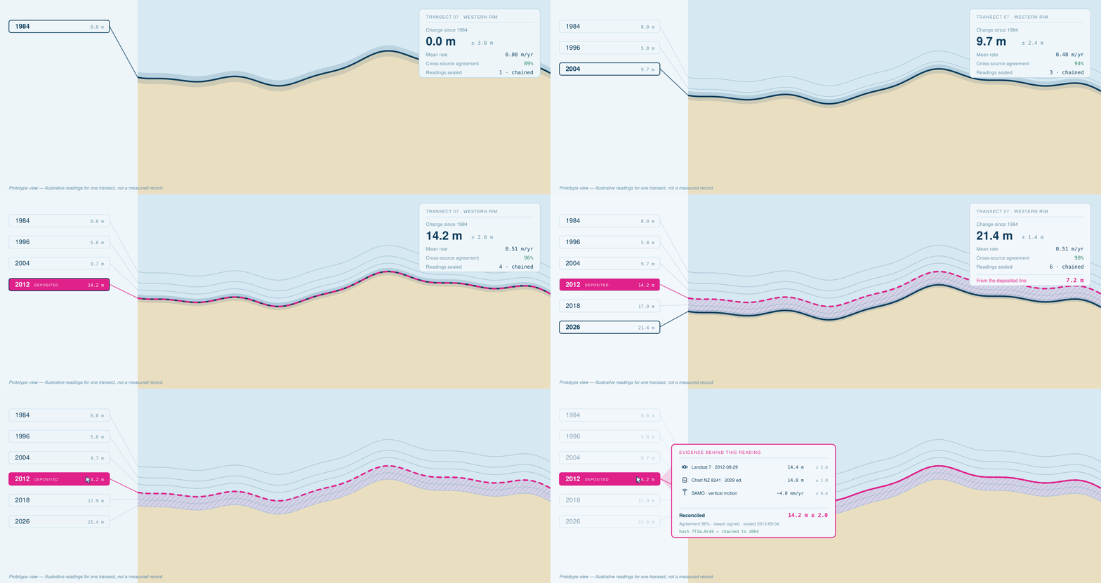
The coastline used to draw the border, from 2012 Where the coast has actually moved to since

Illustrative. The point is that a gap can open up, not its size here.

First, the basics

1

Sea levels are rising, and low-lying Pacific islands are seeing their coastlines erode, shift, and in some cases disappear.

2

Every coastal country's "maritime baseline" — the line along its coast that its entire ocean border is measured from — was mapped once, using the coastline as it stood at that time.

3

That ocean border matters enormously. It determines who can fish there, and increasingly, who can mine the seabed there — often worth far more than the tiny strip of land it's drawn from.

4

The law says the original line can still count, even as the coast changes. But if anyone ever challenges it, it isn't decided by pointing at an old map — it's decided by evidence of what the coast actually looked like.

5

Right now, almost no one is keeping that evidence. Hold the Line is built to keep it automatically, going forward, using free satellite images.

These are small nations with enormous oceans

Tuvalu and Kiribati are tiny by land. Their ocean territory tells a completely different story.

Tuvalu

≈ the size of New South Wales Ocean territory, against just 26 km² of land.

Kiribati

3.4 million km² — bigger than India Ocean territory, against just 811 km² of land.

That ocean territory isn't abstract — it pays the bills.

A$39.0m of Tuvalu's A$93.0m annual revenue comes from fishing licences alone
Fishing licences 41.9%Everything else 58.1%

That money funds health clinics, teachers, and the boats that connect the islands — all resting on where a line was drawn along a coast that keeps changing.

Why "trust me" isn't enough

This isn't a hypothetical risk. It has already happened to another country.

A country lost its claim over a few centimetres

Colombia once claimed a set of small islands, backed by an expert survey. The other side in the dispute didn't even attack the survey itself — just the method used to measure sea level. Colombia couldn't defend the method, and lost the claim to all but one tiny feature.

The lesson: it's not enough to have drawn the line correctly once. You need an ongoing, independently checkable record — and the stakes for the Pacific are only growing, as countries start licensing seabed mining in these same waters.

What the registry actually does

It turns free, publicly available satellite images and tide data into a simple, continuously updated record — automatically, without needing a survey team on the ground.

  1. Confirms what the coast looked like when the original line was drawn.
  2. Checks that key features are genuinely above water at high tide, not just on paper.
  3. Keeps watching. Every five days, a new reading is added and measured against the official coordinates — building an unbroken record over time.

So if anyone ever questions where the line should be, the country doesn't have to argue from memory. It can simply produce the record.